Free map maker tools for daily use to solve small mapping problems.


Free online mapping tools are very useful for students, researchers, professional and other planners to conduct day to day tasks without indulging into complex GIS mapping software. These free GIS mapping tools offer a variety of functionalities from very basic GIS mapping tasks to complex GIS Mapping analysis tasks. Users can easily upload data in the form of CSV, geoJSON or ESRI shapefiles to webgis map with options of different base maps including Openstreet Maps and Satellite imagery. You can view your own geographic coordinates data on online GIS street map. This way you can perform many tasks on your own data.
These free map maker applications allow you to perform variety of tasks that can help you in day to day life. For Example you can get the altitude, degrees and angles on your land where you drop the pin or you can enter your postal code to get the required information.
Free Map Tools List:
- Radius Map Online – Measure Radius on Map : Radius Map Tool is a very simple easy to use web map tool. With the help of this tool, you can draw a circle of your desired radius on map at given location. You can easily move and edit the circle on map by changing its color, radius and location. You can download the map as jpg.
- Calculate Area on Map Online- Land Area Calculator Map: Area Calculator on map is a free area map tool. This area calculator tool using web map allows you to find out the area in multiple units that is enclosed inside a closed polyline overlaid on a map. You can also download the data in geojson format.
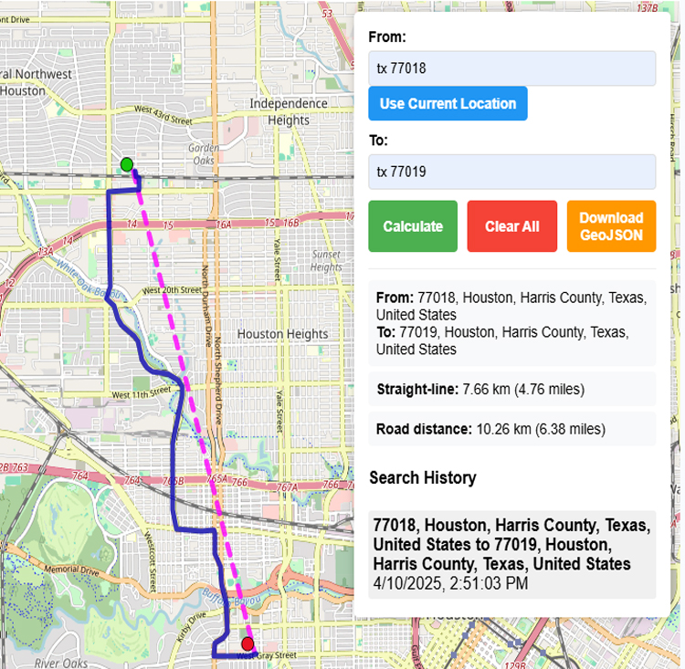
- Distance Calculator on Map Between Two Addresses: Distance Calculator on map is a very intuitive& simple free GIS web tool to calculate distance between two locations. It provides street or driving distance as well as straight distance. You can also download route data in the form of geoJSON to use on any GIS software.
- What is My Elevation Right Now – Calculate Elevation on Map: Get your current elevation on map using this free online web map application. Just locate yourself on map and get the altitude of specific point. You will get elevation using 90 meter resolution dataset. It means accuracy of the elevation is approximation under 90×90 meters.
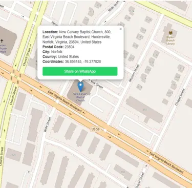
- What is My Postal Code – Find Zip Code on Map: If you are looking for your postal code / zip code then this free web mapping tool will help you to find your current postal code. You can also share your address along with postal code on whatsapp to your friends and family.
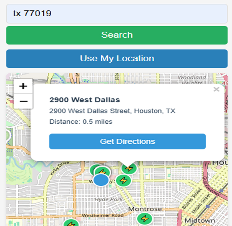
- EV Charging Stations Near Me Map Finder – Google Map Directions: Find electric vehicles charging stations on map and get google maps driving directions from your current location or searched address to the nearest electric car charging station. Map of charging stations. The shortest route to the charging station you need.
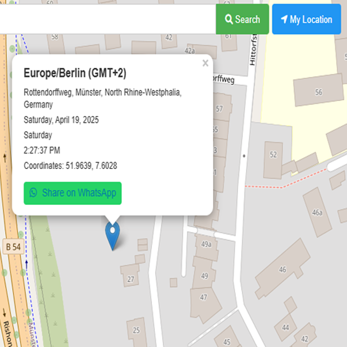
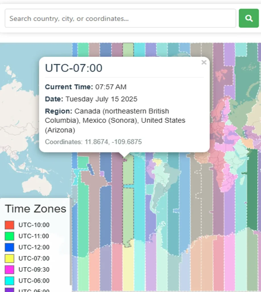
- What is my time zone on map – Free World Time Zone Locator: Simple user friendly web mapping application to find time zone on map by simply searching the address, postal code, geographic coordinates. You can also search for current time zone by just click my location on map. Click on map and you will be provided detailed information about your current time zone.
- GPX File Reader Online – View Hiking, Cycling, Running Data on Map: Free gpx viewer mapping application 100% free to use built with free resources and copyright free data. Upload gpx files online by simply drag and drop or browse local directory of phone or PC. View outdoor recorded activities like cycling, running, hiking etc on map with path covered, distance covered and elevation profile.
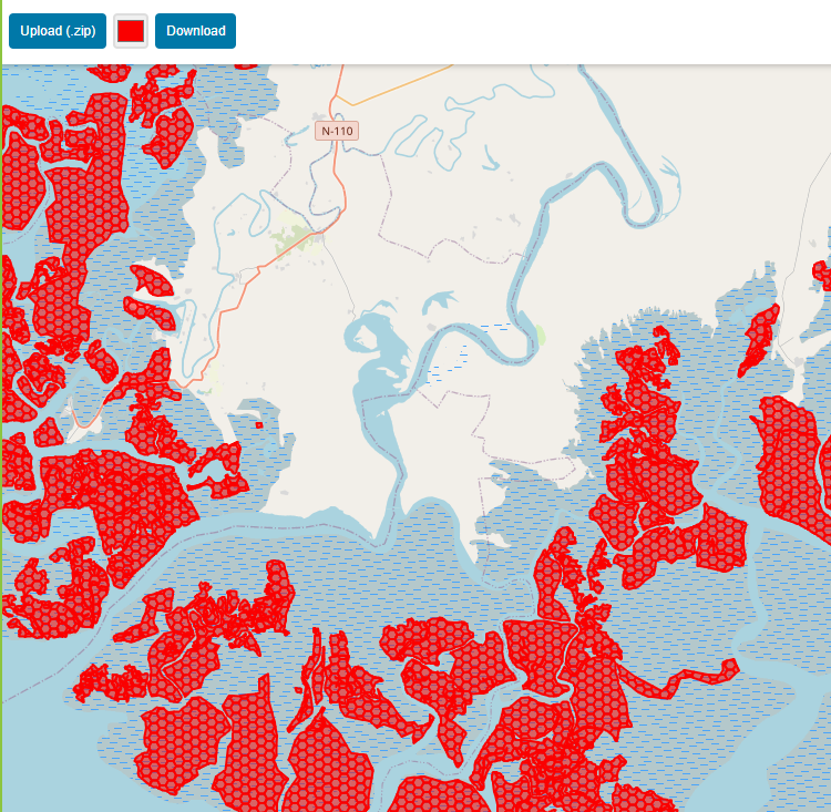
- Esri’s shp Viewer Online – Upload Shapefile on Map Online: Want to view your GIS data in Esri Shapefile .shp format on map online? Use our shp viewer free application tool to display your shp file format data online. Map can also be exported using this shapefile viewer online application.
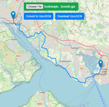
- GPX to GeoJson Data Conversion Tool – Free Geodata Converter: Do you need to convert your GPS data stored in GPX format to well known GeoJSON data. This free web tool will do this job for you. Just upload data, convert and download the required format.
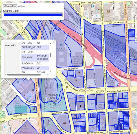
- Free KML KMZ Map viewer- Display .kml Data on Map Online: Free viewer for KML and KMZ maps online. web tool to view KML, KMZ files on street map and satellite image.
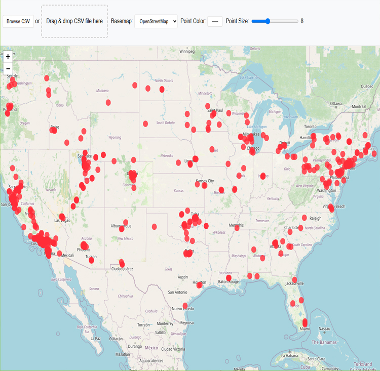
- Map Maker from CSV File – Latitude & Longitude Geographic Coordinates: Free online map maker from GPS coordinates in the the form of Latitude & Longitude stored in CSV file format.
- Online Time Zone Map – Interactive World Time Map: Use this world map of time zones to determine boundaries of each time zone. Current time of any country on single page. Just click the county location and get your desired information.
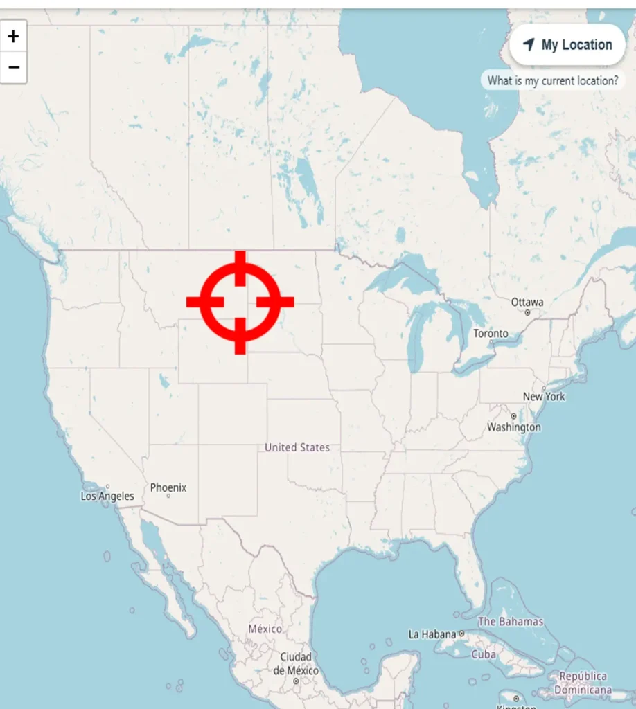
- GPS Coordinates – Latitude and Longitude Finder: Simple map application to find current latitude and longitude on map just by one click. Get your current location and share it via whatsapp.
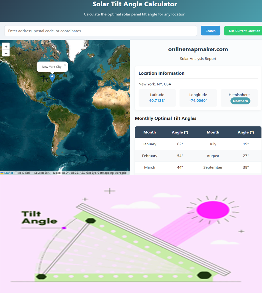
- Optimal Angle for Solar Panels Calculator – Solar Panel Installation Guidelines: Calculate optimal angle for your solar panel By your address location and time of year or Use your current location of site. Detailed report download in PDF.
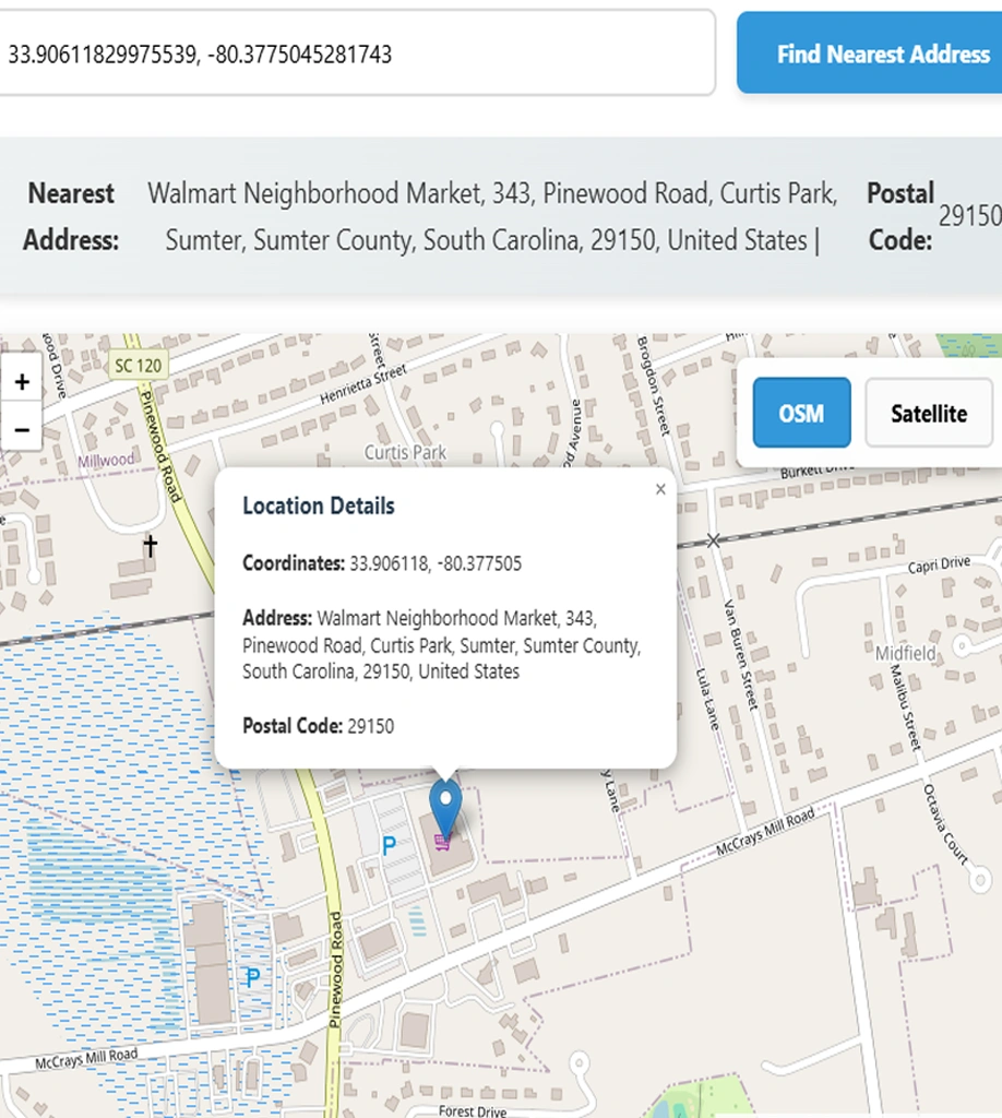
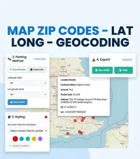
- Find Address by Location Lat Lon – Latitude Longitude to Address Conversion Tool: Very useful free map based tool, simply put your coordinates in decimal degrees (Latitude & Longitude) in search bar and get nearest available street postal address along with postal code.
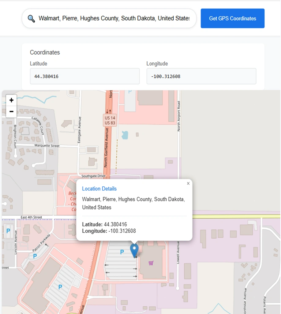
- Free Geocoder Application to Convert Address to Lat Lon: Simply write your address in search bar, application will suggest the possible address available for geocoding. Select from dropdown and map will show your desired location along with lat lon coordinates.
Coordinates and Spatial Reference Tools List:
UTM Zone to EPSG Code Finder: Select UTM Zone and this tool will provide respective EPSG Code
Acknowledgment:
Open Source Resources